

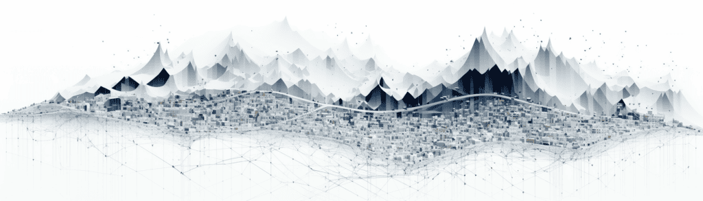
- Unveiling the Magnitude of Geospatial Data
- The Extensive Applications of Geospatial Data
- Methods for The Collection of Geospatial Data
- The Innumerable Benefits of Geospatial Data
- Understanding the Constraints and Limitations of Geospatial Data
- Storing the Wealth of Geospatial Data
- Expanding Utilisation and Applications of Geospatial Data
- A Wide Stakeholder Base for Geospatial Data
- Overcoming the Hurdles of Geospatial Data
- The Future Forward with Geospatial Data
- How We Can Help
Unveiling the Magnitude of Geospatial Data
Geospatial data, often interchangeably referred to as spatial data, serves as critical information about the geographical location and the characteristics of natural or constructed structures and boundaries on Earth.
This specific type of data directly correlates with a physical address, place name or a geocoded coordinate system.
The realm of geospatial data is enormously encompassing. It includes aerial imagery, an array of satellite data, numerous types of maps, and unique geographical features, to list a paltry few.
The significance of geospatial data is immense as it essentially constitutes the foundation of geographic information systems (GIS) and location-based services, contributing key insights into spatial and temporal patterns defining our world.
The Extensive Applications of Geospatial Data
Integrating geospatial data covers a broad spectrum of applications in copious sectors. For instance, in urban planning, it significantly influences the design, creation and management of urban landscapes, infrastructure, and intricate transportation systems.
In environmental sciences, geospatial data plays a pivotal role in understanding and interpreting complex patterns of climate change, robust wildlife tracking, and effective ways of managing natural resources.
For the commercial sector, companies leverage geospatial data as a valuable tool to geo-locate customer locations, implement geo-marketing strategies, and optimise supply chain routes for improved logistics management. Furthermore, the public safety sector maximises using geospatial data for effective disaster response tactics, mapping out areas prone to criminal activities and executing comprehensive crisis management plans.
Methods for The Collection of Geospatial Data
Geospatial data can be amassed through a multitude of conventional and modern methods. Traditional techniques employ surveys, cartography, and aerial photography.
In contrast, contemporary methods harness the power of technology to collect more precise and real-time data. They include using the Global Positioning System (GPS), satellite imagery, Light Detection and Ranging (LiDAR), and unmanned aerial devices, more commonly known as drones.
Also, with the advent of the Internet of Things (IoT), a considerable proportion of geospatial data is generated via connected sensors and devices.
The Innumerable Benefits of Geospatial Data
Geospatial data provides a myriad of benefits. Primarily, it delivers vital insights that are essential for decision-making across various sectors, enabling more efficient strategies and effective policies.
Secondly, geospatial data enables real-time monitoring and tracking, significantly boosting operational efficiency. Another major perk is that it drives growth and innovation by facilitating the introduction of new applications and services, especially in the e-commerce, logistics, and tourism sectors.
Understanding the Constraints and Limitations of Geospatial Data
Despite the numerous advantages of geospatial data, its potential limitations cannot be ignored. As mentioned earlier, enormous datasets can create significant data processing and management challenges.
There are also concerns about data quality, as errors and inaccuracies can compromise the validity of analyses based on this data. Geospatial data also raises sensitive matters of privacy, as it can potentially reveal sensitive personal and organisational details.
Storing the Wealth of Geospatial Data
Geospatial data is stored in precisely designed spatial databases capable of managing and storing data related to geographic locations.
These specialised databases can handle various types of spatial data, such as points, lines, and polygons, notably support spatial queries and operations.
Their ability to execute spatial queries and operations truly sets these databases apart. This means you can ask complex questions about spatial relationships, such as “Which retail outlets are within a 5-mile radius of a specific location?” or “What is the shortest route between two points?” and receive precise answers.
Advanced algorithms and indexing techniques, like R-trees or Quad-trees, are employed to make these operations fast and efficient.
Expanding Utilisation and Applications of Geospatial Data
The use cases of geospatial data are multifaceted and stretch beyond traditional applications. Besides its use in the fields mentioned above, geospatial data can also be used in healthcare for mapping disease outbreaks, in agriculture for precision farming, in the insurance industry for risk assessment, in telecommunications for network planning and in retail for optimal store location selection.
In disaster management, real-time geospatial data can be critical in tracking the spread of a wildfire or the path of a hurricane, enabling faster and more effective response. In marketing, geospatial data can help businesses understand consumer behaviour in relation to geographic locations, thereby improving targeted advertising strategies.
Also, geospatial data is increasingly being used innovatively – seen in augmented reality games and its integration into social media platforms for advanced features.
A Wide Stakeholder Base for Geospatial Data
Geospatial data finds beneficiaries in a wide range of users. From governments, businesses, scientists, urban planners, and environmentalists to emergency services, all harness the potential of geospatial data in their respective fields.
As geospatial data becomes more accessible and comprehensive, its use is set to grow, continually shaping our understanding of the world and influencing our decisions in new, innovative ways.
Overcoming the Hurdles of Geospatial Data
Despite the numerous benefits and applications, utilising and managing geospatial data is not without its unique set of challenges. The sheer volume of geospatial data can be overwhelming and daunting to manage, particularly given the increasing use of satellite imagery and drones, which generate enormous amounts of information.
The accuracy and reliability of geospatial data can pose significant challenges.
Geocoding issues, inaccuracies in the source data and outdated information can undermine the utility of the data. Moreover, using geospatial data raises potential concerns about privacy and security since it often discloses exact locations and potentially contains sensitive details.
The Future Forward with Geospatial Data
The future trajectory of geospatial data is incredibly promising. With the continuous evolution of technology, we can anticipate more accurate, high-resolution and real-time geospatial data becoming readily available.
Furthermore, the advancements in artificial intelligence and machine learning are set to enhance the analysis and interpretation of geospatial data.
As our society becomes increasingly digitised, geospatial data is expected to play a key role in many sectors – from smart city planning, autonomous vehicles, and climate change modelling to disaster management.
How We Can Help
At EfficiencyAI, we combine our technical expertise with a deep understanding of business operations to deliver strategic consultancy services that drive efficiency, innovation, and growth.
Let us be your trusted partner in navigating the complexities of the digital landscape and unlocking the full potential of technology for your organisation.